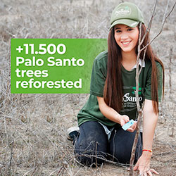
We are a company that works in a sustainable and responsible way with the environment. The commitment to give back to nature what we take from it is present in our DNA. This is why, for many years, we have been developing a program of constant reforestation and monitoring of our forests, where we protect not only the Palo Santo species, but also those species that are part of the dry forest ecosystem and that allow the symbiosis between these plants.
Our work has consisted of restoring dry forests, caring for and protecting the Bursera Graveolens (Palo Santo) species through our Palo Santo Tree Reforestation Program and educating people on how to work with Palo Santo in a friendly way and sustainable with the environment.
Our process of reforestation and constant monitoring of palo santo trees has helped us to obtain information regarding this sacred tree, helping to clarify several questions raised for a long time about Bursera Graveolens.
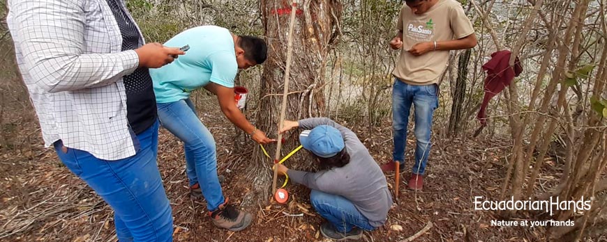
For this research, 24 permanent sampling plots were placed within 50 ha of the protective forest. We place these plots in an area of 500m2 each.
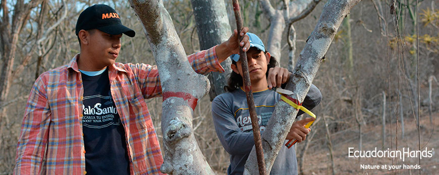
Within the area of each one of the plots, we identified trees with more than 5cm in diameter (DAP) including palo santo trees, which were georeferenced and tagged to monitor their development.
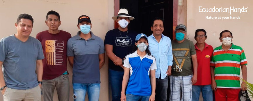
In October 2020, after a year of data collection, we returned to the forest to carry out the corresponding monitoring of the trees to know the conditions that they are. We carry out this activity in conjunction with students from the Faculty of Agriculture of the University Eloy Alfaro de Manabí (ULEAM). The data collected will be very helpful to publish new scientific articles, how to determine the increase in volume and storage of carbon in aerial biomass.
We are currently working on the "Finca Los Bajo de Pechiche" in the city of Montecristi / Manabí / Ecuador, in collaboration with the Eloy Alfaro University of Manabí (ULEAM) and the Technical University of Manabí (UTM), in order to obtain data and publish new scientific articles and make a comparison with Joa's forest.
For this new phase we use the Dry Flor protocol (Floristic network of seasonally dry tropical forests) for the establishment and monitoring of plots (called DRYFLOR Protocol), it guides the long-term monitoring of woody elements (trees and lianas) in permanent forest plots. dry, through a standard protocol for monitoring biomass, composition changes and dynamics of woody vegetation; with the idea of relating these observations to floristics, soil conditions and climate.
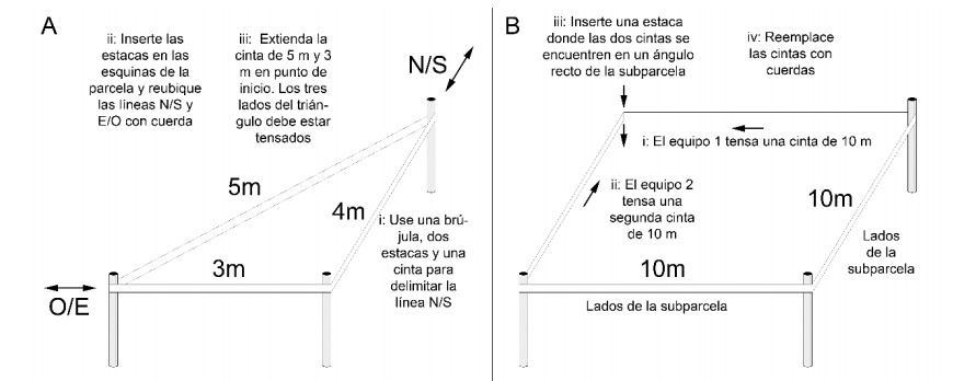
Following the parameters of the DryFlor protocol, we created a plot located 200 meters above sea level, measuring 5000 m2 corresponding to half a hectare, which was divided into 50 subplots measuring between 10 x 10.
According to the Dry Flor protocol, it indicates that the most precise way to delimit a plot is to mark its edges and each of the subplots with rope. A perfect right angle can be obtained initially by delimiting a right angle triangle with sides 3, 4 and 5 m long, with the 4 m side in the North / South direction and the 3 m side in the East / South direction. West .
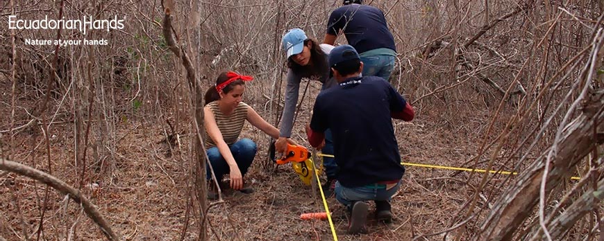
This triangle must be perfectly horizontal. Marking the edges of the plot with rope works very well with three people: one works with the compass; another works doing the trail; and another measures distances. The demarcation of the subplots works very well with four people on two teams. Each team delimits, cuts, and places the rope on one of the 10 m sides of the subplot with a rope and the point where the ropes of both teams meet is the new corner of the plot.
Within each subplot we proceeded to identify each of the tree species and according to the Dry Flor protocol; A minimum set of procedures must be defined, balancing the criteria detailed above and the need to generate ecologically significant and comparable data.
Within these parameters we must place the parcel number, the subplot number, record a georeferencing point taken by the GPS in the center of the parcel, record the tree number by means of a plate, place a GPS point of the tree To be able to locate it in subsequent monitoring, take a photo of the tree, record if the species is alive or in what conditions it is found, we proceed to measure in Diameter, height of the tree, observe if the tree species is infected by lianas, taking into account the cup.
These data that we record in the forest bajos del Pechiche can be compared with the data obtained in our forest located in Joa and thus we will carry out new scientific articles that will clear up doubts about the dry forests and the Palo Santo tree and above all the importance which is to care for and protect these types of forests as they help with the reduction of the carbon footprint. Our results in Joa showed that it stores 100 megagrams per hectare, which corresponds to 80% of a forest, which we can find in our scientific articles.
Leave a comment
Comments
Bajos del Pechiche y Joa, Montecristi
By: Marolyn On 06/14/2022
Rating:
5.0
Hola que tal Ecuadorian Hands.
Me gustaría saber donde puedo leer más de sus artículos de comparando la comuna Bajos del Pechiche y la comuna Joa
Replied by:
Jean Carlos Chávez
On 06/20/2022
Hola Marolyn puedes leer nuestros artículos científicos en los siguientes enlaces
https://ecuadorianhands.com/es/blog/category/articulos-cientificos-indexados.html
Importancia de preservar y mantener los bosques de Palo Santo, Estudio sobre el almacenado del carbono en el bosque seco tropical https://ecuadorianhands.com/es/blog/post/preservar-mantener-bosques-de-palo-santo.html
Influencia del gradiente altitudinal, Composición y estructura del “Bosque protector El Artesan - EcuadorianHands”, Joa, Jipijapa
https://ecuadorianhands.com/es/blog/post/gradiente-altitudinal-composicion-y-estructura-del-bosque.html
Genuine Panama Hat (Montecristi), HandWoven, 100% EcoFriendly, 100% Toquilla Straw. You'll look gorgeus at any time wearing the best hat of the world!
It keeps you cool and at the same time it provides comfort.
It...
Genuine Panama Hat (Montecristi), HandWoven, 100% EcoFriendly, 100% Toquilla Straw. You'll look gorgeus at any time wearing the best hat of the world!
It keeps you cool and at the same time it provides comfort.
It...
Therapeutic Grade. Perfect for Aromatherapy.
Natural-sleeping-and-good-vibes stimulant.
Increases the feeling of calm and well-being.
Helps to strengthen your immune system.
Supports restoration of the dry...
Attract fortune and well-being to your home with the positive vibrations of PALO SANTO. Purifies large areas. Its magical aroma will eliminate all negativity, including bad odors and mosquitoes!
The palo santo powder...
Palo Santo, the natural energy that does your body good. Boost your energy!
For daily use
Pleasant and subtle citrus-woody aroma that provides calm and well-being.
Hydrates and protects your skin against stains,...
NATURAL DIFFUSER! Smelling Palo Santo is like wearing an amulet or being a magnet for good things. Our Good Vibes Bracelet plant trees! Each bracelet includes 1 ml of palo santo 100% essential oil to recharge the...


")


Leave a comment
Comments
Bajos del Pechiche y Joa, Montecristi
By: Marolyn On 06/14/2022Hola que tal Ecuadorian Hands.
Me gustaría saber donde puedo leer más de sus artículos de comparando la comuna Bajos del Pechiche y la comuna Joa
Replied by: Jean Carlos Chávez On 06/20/2022